Greetings
Welcome to Gujwa Village Tourism Cooperative
Gujwa Village Tourism Cooperative combines local tourism and economic revitalization by introducing the natural beauty and local tourism resources of Gujwa-eup, and developing and proliferating diverse tourism contents.
Through this project, we will flexibly respond to the rapid changes in the local society and strengthen the competitiveness of local companies to contribute to the vitalization of the local economy.
President of the Gujwa Village Tourism Cooperative
About the Project
Jeju Balanced Power Generation Project
The Jeju Balanced Power Generation Project is a public service improvement project aimed at reducing regional gaps in Jeju.
The purpose of the project is to promote regional characteristics and balanced development, and to improve the happiness of residents while improving quality of life through the discovery of projects for enhancing regional competitiveness.
Promotion System
Regional balanced power generation projects are carried out in each eup, myeon, and dong region under the guidance of the Jeju Special Self-Governing Province Regional Balanced Development Ordinance.
What are balanced development projects at the eup, myeon, and dong levels?
These are projects in which the Ordinance discovers and implements projects centered on the local residents at the eup, myeon, and dong levels in Jeju Special Self-Governing Province.
Such projects are aimed at strengthening the business capabilities of local residents while simultaneously supporting projects that meet their needs as they discover and operate their own projects.
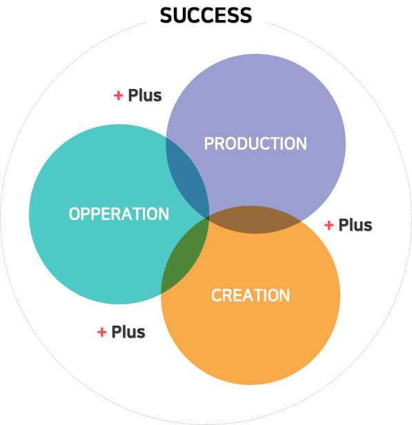
Business System Diagram

Gujwa Village Tourism Cooperative
- Local core business entity
- Producing high quality products in the Gujwa region
- Spreading results through cooperative projects between local areas
Gimnyeong-ri United Youth Association
- Overall business operation
- Fostering self-reliant promotional entities with experience and competency
- Promoting sights, recreation, and eateries in the Gujwa area
Jeju National University LINC+ Project Team
- Discovering linked programs through MOUs
- Discovering unique strategic project programs
- Linkage to the utilization of crops produced in Gujwa-eup
- Capstone Design linkage project
About Gujwa-eup Village
Gujwa-eup History
A village was formed in Gujwa-eup and the establishment of a full-fledged administrative system began in 1300 AD, which was during the reign of King Chungnyeol of Goryeo.
At that time, Tamlaheon was ruled by establishing Dohyeon in the east and west.
Gimnyeongchon Village was established in the current district of Gujwa-eup, and it can be said that the formation and development of this village was the beginning of Gujwa-eup.
In 1874, Jwa-myeon was divided into Shinjwa-myeon (New Jwa-myeon) and Gujwa-myeon (Old Jwa-myeon), and at this time, there were 14 administrative districts of Gujwa-myeon, which were: Dongbok-ri, Dongkimnyeong-ri, Seokimnyeong-ri, Deokcheon-ri, Woljeong-ri, Haengwon-ri, Handong-ri, Pyeongdae-ri, Songdang-ri, Sehwa-ri, Sangdo-ri, Hado-ri, Jongdal-ri, and Yeonpyeong-ri.
With the implementation of Doje in 1915, the administrative area of Gujwa-myeon was changed to Gujwa-myeon, Jeju Island, Jeollanam-do.
In 1946, as the US military government allowed the implementation of Doje, it no longer fell under the jurisdiction of Jeollanam-do and belonged to the administrative district of North Jeju-gun, Jeju-do.
In 1951, branch offices were established in Gimnyeong-ri and Yeonpyeong-ri, and in 1980, the area was promoted to the status of 'eup'.
At this time, the Manjanggul Management Office was transferred to the North Jeju County Office.
In 1961, when the military government was implemented, the administrative district of Gujwa-myeon was formed with two branch offices and 14 ri districts.
In 1986, Yeonpyeong-ri was promoted to Udo-myeon and the Gimnyeong local office was abolished in 1998.
Changes were made in the year 2000, such as the integration of east and west for unity among local residents.
Currently, it is composed of 12 administrative districts, 12 legal districts, 60 natural villages, and 220 ban.
Location
The location of Gujwa-eup is geographically about 124 km from Mokpo, Jeollanam-do, and about 287 km from Busan.
It is about 35 km away from Jeju-si and is located at the eastern end of Jeju Island.
The northeast side faces the South Sea, the west borders Jocheon-eup, and the southeast borders Seogwipo-si.
Climate
The temperate monsoon climate is hot and humid, and 44% of the annual precipitation falls in the three summer months of June, July and August.
Area
The total area is 185.66㎢, which accounts for 10% of the total area of Jeju.
It has the second largest area among the eups and myeons of Jeju-si.
The area of arable land is roughly 43㎢, accounting for 23% of the land, which is similar to the national average.
Terrain
Gujwa-eup is located on the east side of Jeju Island.
It is the farthest away from Mt. Hallasan and has a fan shape that is almost an equilateral triangle.
The northeast coastline is extremely curved, and basalt reefs have formed all over.
There are villages such as Dongbok, Gimnyeong, Woljeong, Haengwon, Handong, Pyeongdae, Sehwa, Hado, and Jongdal-ri in the coastal zone, and Deokcheon and Songdang-ri in the mountainous area.
Sangdo-ri is located between the coast and the mountainous area.
Mountains
Most of the mountains in Gujwa-eup are distributed throughout the mountainous region, mainly concentrated in Songdang-ri.
There are 40 mountains in total, of which 26 are horseshoe-shaped, 7 are circular, 1 is conical, and 6 are mixed.
Located at the eastern end of Jeju-si, Gujwa-eup is the most liveable and cleanest area in the country and features a long coastline and vast pastures.
It is the main production area of carrots, onions, and garlic in Korea, and is home to many scenic spots and tourist attractions such as Manjanggul Lava Tube, Gimnyeongsagul Cave, Dangcheomulgul Cave, Bijarim Forest, Moonjuran Island, and Gimnyeong Beach.


